Pages

Monday, May 7, 2012

Well, There Goes Dinner: From Xela to Xela Again

My thoughts at 3:00 a.m. as I tried not to get vomit on my pant cuffs.

I'm not sure why I always have *ahem* "tummy problems" on the road. Probably because I eat whatever I can find that's cheap and looks weird. In this case, though, I lost a delicious and perfectly safe pesto pasta dinner prepared by my guides.
siiiiiick
So that was the worst part of the "Lago Trek" from Quetzaltenango (Xela) to Atitlan. Now the good stuff!

Dave and I wanted to check out Lake Atitlan, and we figured walking would be a good way to cover the +/-50 km. Coincidentally, this happens to be Quetzaltrekkers's most popular trek. We'd hung out with the QT guides, friends, and clients at Casa Argentina, where we were staying and where QT is headquartered. It's nice to find a little community when you're away from home.

The trek started with a chicken bus ride to Xecam, a small village near Xela. From there, we spent most of the day walking through forests, meadows, and rural agricultural fields to the village of Santa Catarina, where we spent the night in the municipal hall (and where I lost my pesto pasta).
the grassland, nicknamed "alaska"
I awoke the next day feeling pretty rough—dehydrated, sick, and way over-tired. Sounds like good form for hiking! I (foolishly?) decided I would stick with the group and would hike the 12ish miles to Santa Clara. I did okay until the final hour, when I could barely stand up straight due to the pain and nausea. I collapsed as soon as we arrived at the home of Don Pedro, our host. After a few spoonfuls of rice for dinner, I fell asleep to the distant sounds of Don Pedro playing the guitar and his grandson singing in a Mayan language.
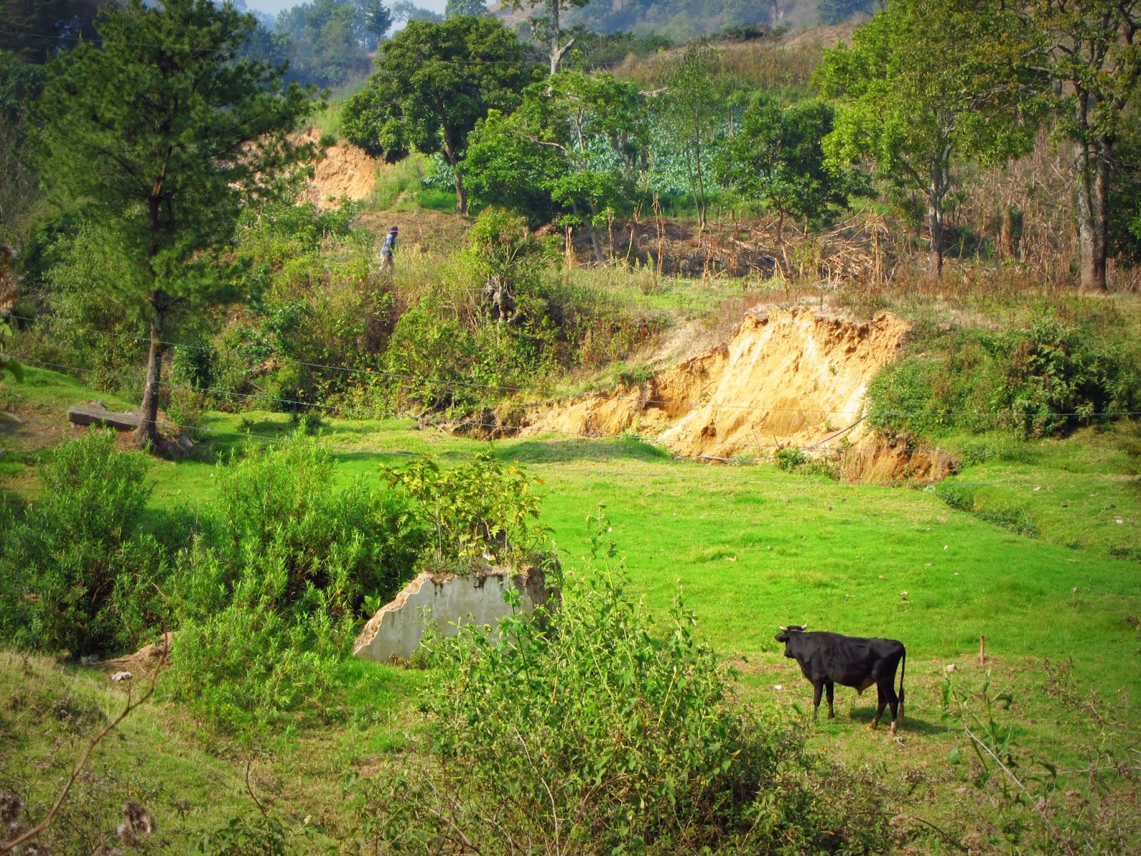
countryside
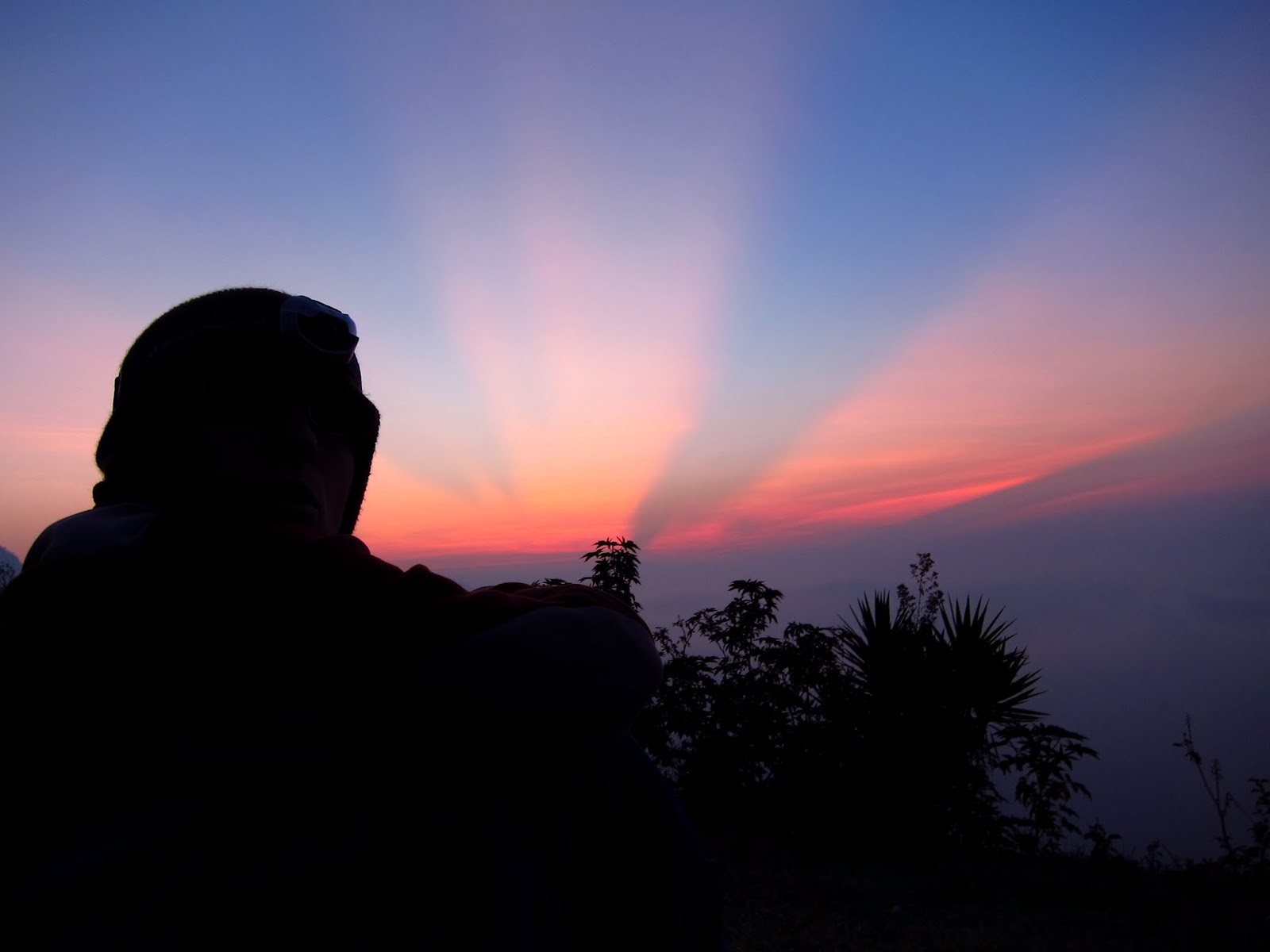
Wake-up call on the third day was 3:45 a.m. When you go to sleep at 8:00 p.m. that's not too bad! We hiked less than an hour up to a mirador overlooking Lake Atitlan. We were treated to the beginnings of a beautiful sunrise... and then the clouds rolled in. Oh well! I was feeling much better, so the hike down to the lake went quickly. From there, all 17 of us, plus backpacks and driver, piled into a pick-up truck to drive the 10 minutes between San Juan La Laguna and San Pedro La Laguna (apparently this small stretch of road is prone to robberies).
watching the sunrise over lake atitlan
Compared to the Nebaj trek, the hiking was easier (less uphill, warmer weather, sleeping inside, half the length). The group was much bigger and the trek was shorter, so I didn't get to know everyone as well. The region where we hiked was much less remote, local residents were friendlier, so it didn't feel like I'd fallen off the map. Minus the sickness part, it was a great hike.
the cross, the virgin, and the volcano
So we're at Lake Atitlan. Now what?
lake views
We spent one night in San Marcos, which has a bizarre hippy New Age feel to it, and one night in San Pedro, which has a bizarre generic tropical backpacker hub feel to it. To me, Lake Atitlan felt just as overrun with tourists as Antigua. Tourism can do a lot of great things for a place, and a lot of people love the villages of Lake Atitlan, but I just couldn't get into it. We kayaked one morning, which was nice, but it was time to move on.
kayaking
With only a week left in Guatemala, we decided to head back to Xela, where I could take a weaving course (more on that later) and for a third QT hike. On the way, we stopped off in Chichicastenango for its famous Sunday market, a crazy mix of chickens, dish soap, traditional weavings, tourist souvenirs, jewelry, cell phones, beans, and fruit.
moment of rest on the church stairs
At the moment, we're in Xela. I'm finishing my weaving tomorrow, and tomorrow night we'll be hiking Volcano Santa Maria under the light of the full moon. Then a bus ride to Guatemala City... and back to the USA.

Wow.

Monday, April 30, 2012

The Purple People Hike from Nebaj to Todos Santos

Apparently tiny shoeshine boys like frisbee.  Or maybe they just wanted a chance to be a kid for once.

In the central square in Nebaj, a village in the northwestern highlands of Guatemala, Dave was throwing a disc with a tall guy named Steve.  A dozen little boys fought for their attention and their toy.  Soon four older girls joined in (you go girls!); one of them had a decent throw and sent it to Dave every time (aww!).  Older boys stood around the outside of the circle, looking cool and desperately seeking a way into the circle without looking too eager.  Men sat on the church stairs and watched the show.  Women walking through the square appeared confused, annoyed, and amused.
frisbee in the main square
 A few of the boys crashed into a puppy pile, trying to rip the frisbee away from each other.  Steve, who just spent seven months working in an orphanage in eastern Guatemala, broke up the fight with a twitch of his head and a shake of his hand.  He took away the frisbee and walked out of the square.

The kids followed him.

He sat down on a bench.  The kids crowded around him.  They stared.  He stared back.

Steve launched into the funniest clown routine I've ever seen.  He made faces, pulled his ears, made his eyes big and small.  He made a rock appear and then disappear.  He switched around kids' baseball caps.  The kids squealed and hung their round, wide eyes on his every movement.  The adults around the square, who were pretending not to watch, snorted and smirked.  He was hilarious.
steve clowns with the kiddos
So began our walk through the northwestern highlands of Guatemala, starting in the village of Nebaj and walking west to Todos Santos.  It took six full days, two travel days plus four days of walking, to make the trek.  Here's what we did:


Yellow: places we slept. Blue: villages we walked through.
Buses: where we took public transit. Tree: La Torre, highest non-volcanic point in Central America.
View Nebaj to Todos Santos in a larger map.

We organized the trek through Quetzaltrekkers, an all-volunteer organization that leads outdoor adventures to raise money for Escuela de la Calle, a school and safe haven for disadvantaged youth.

I could go on and on and on about the trek, but Dave and I had so much fun that we immediately signed up for another trek with Quetzaltrekkers as soon as we got back to Xela.  So, this will be a quick summary of the trip.

DAY 1:  Nebaj

Day 1 was a travel day from Xela to Nebaj.  In Nebaj, we checked into a guesthouse for the evening, wandered through the market, and settled into the central square for a bit of frisbee.  The women in Nebaj wear slim, red traditional skirts.  My stomach was still a bit touchy, so I went to sleep immediately after dinner.

the ayudante ties stuff to the roof of the chicken bus... while it's in motion
DAY 2:  Xexocom

Right out of Nebaj, we hit the first big hill of the trip.  We crested the ridge and meandered down to the village of Acul.  This region has a very deep, very tragic history, particularly related to the recent civil war.  Seventy-nine out of 80 villages in the region either suffered massacres or were burned to the ground.  In Acul's case, villagers were forced at gunpoint to hurt and kill each other.
the village of acul
 After our somber break in Acul, we hiked through green pastures to, of all things, a cheese farm run by Italians.  It's a small world, after all!  We passed through the village of Xexuxcap and out of town along a dirt road.  The scenery reminded me so much of the Himalayan foothills in Nepal, steep and green and steep.  We followed the dirt road as it climbed across a hill and arrived in Xexocom, our home for the night.
reminds me of nepal...
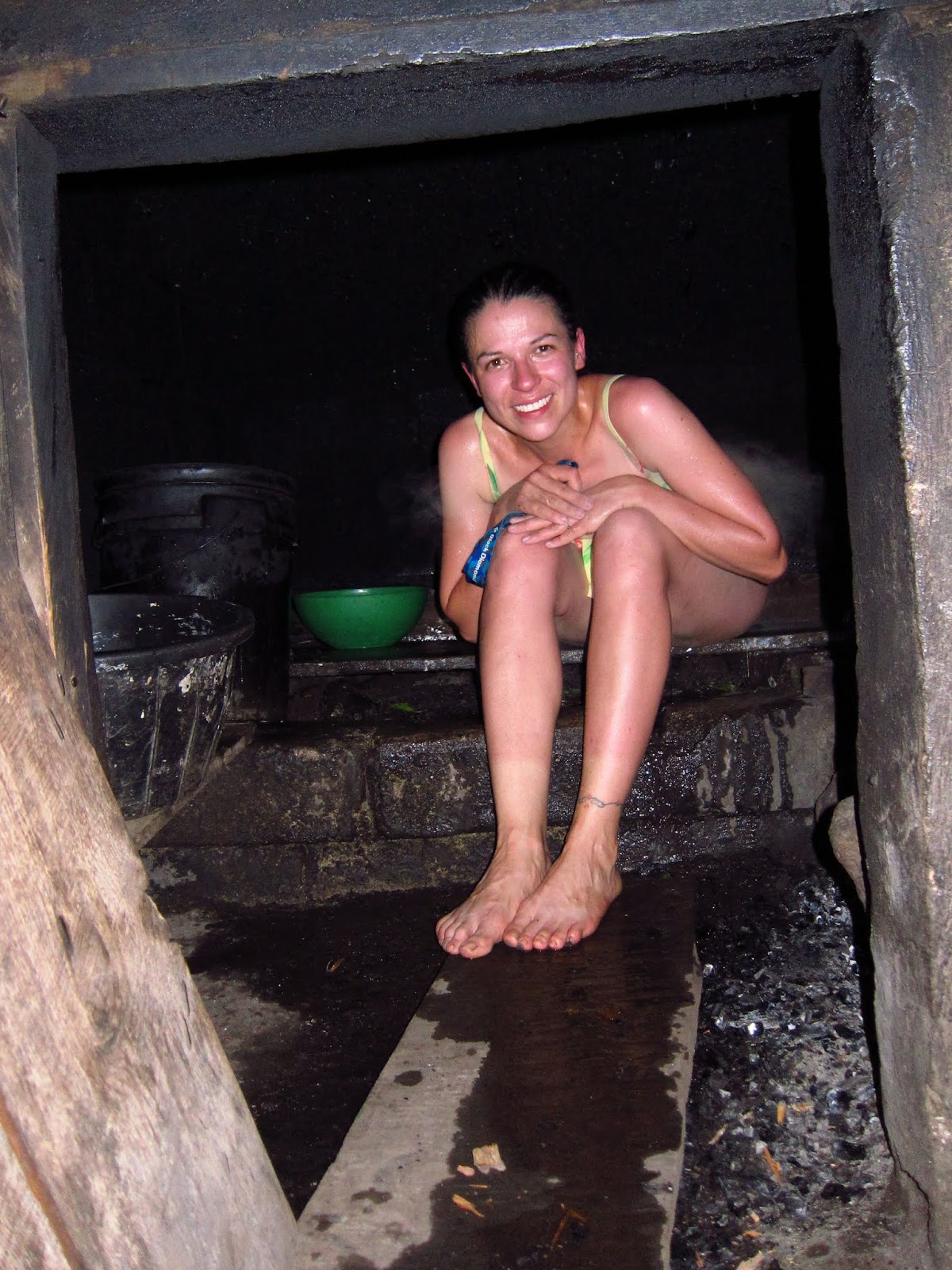
We set up our camp in a school house.  Then, we took turns in a local family's tamascal, or traditional mayan sauna.  It was dark and steamy, relaxing and refreshing.  We had a dinner of rice, beans, an egg, and lots of corn tamales prepared by the same family.  Quetzaltrekkers rotates host families in the community so everyone can benefit.  Apparently, this is a nice economic boost for families, for not a lot of extra work.  Good to see money going directly to people who rarely, if ever, benefit from international aid.
camping out in the school
DAY 3:  Canton Primera

3:30 a.m. wake-up call, and we're hiking by 4:00 a.m. up the hill of 87 switchbacks.  It wasn't too bad, lots of huffing and puffing but it was so steep that we made fast progress.  We watched the sun rise over Acul, and Nebaj beyond.  Most of the way up the hill, we stopped for breakfast and basked in the morning sun.  From breakfast we hiked uphill again to reach the edge of the altiplano.
first glimpse of sun
I have never seen anything like this altiplano before.  Lots of green pasture, interrupted constantly by grey rocks of every shape and size.  Really stunning scenery!
shepherd on the altiplano
We passed through the villages of Chuatuj and Chortiz.  This was probably the most remote place I've ever been.  Instead of people smiling and waving, villagers stared from a distance, or just ran away entirely.  Our guides told us a story about a trekker pulling out a camera in Chortiz to take a photo of some kids.  The kids dropped to the ground and cowered; they thought the camera would steal their souls.  I have very few photos of people from this trip, even though they wear beautiful clothing.
distant horseman
The weather clouded up and it looked like it would rain.  Nice atmosphere to hike across the altiplano.  At the edge, we descended into the Pericon Valley to the village of Canton Primera.  There, we set up camp under the eaves of a decaying school.  We made a campfire and ended up cooking our pasta over the flames.  Played a game around the fire until an early bedtime.
dinner over the campfire
DAY 4:  La Ventosa

First thing in the morning, we walked down to the Pericon River, where we made breakfast and took a long break.  Looong break--this group does 2-3 hour meal breaks!  Dave and Lisa jumped in the freezing water.  Crazy.
crazy.
The hike out of the Pericon River Valley, through the village of El Pericon, and onto the second altiplano was way longer and harder than I expected.  I had the "Day Three Blues" (the third consecutive day of hiking is always the hardest).
pericon river
The second altiplano was not as spectacular as the first.  We followed a dirt road through scrubby pastures to the village of San Nicolas, which had a road.  People here have much more contact with the outside world; they waved and smiled as we passed.
guy on his bike, driving a few horses loaded with firewood
We had lunch under the shade of a lone tree, within sight of "The Hill of Terror."  It actually wasn't that bad. Dave was sick and he did it in under 10 minutes.  Crazy.
thumbs up (then he puked)
Descending the Hill of Terror, we ended up at the paved highway in La Capellania, where we picked up a microbus to cut out the walking along the highway.  We spent the night in La Ventosa with a man named Geronimo and his family, where we enjoyed another tamascal and a dinner of mashed potatoes with tortillas (starch and more starch).
sweating in the tamascal
DAY 5:  Todos Santos

We left La Ventosa with one of the family dogs, named Negrita, who would follow us all the way to Todos Santos and spend the night with us.  She does this with every group, enjoying the attention and the food the trekkers slip to her.

More uphill.  This trek actually does have more uphill than downhill, which is fine for my knees.  This uphill wasn't too steep, and we made good time up to La Torre, the highest non-volcanic point in Central America.  Ginny shared a very sad story about Geronimo's family and the village of La Ventosa from the civil war as we looked out over the valley.
view from la torre
From the high point of the trek, there was nowhere to go but down.  Down, down, down.  We descended through a cloudy, misty pine forest into a lush, mossy forest.  Down, down, down.  Eventually I needed a break for my knees (and my brain, downhill takes concentration!).  Turns out we were only 15 minutes from our lunch break, which we took at the base of a beautiful cliff overlooking the Todos Santos valley.
beautiful lunch break location!
The rest of the walk was easy; a Peace Corp volunteer had raised funds to construct trails within this park.  At the highway, I decided to take a bus directly to Todos Santos with Dave, as he wasn't feeling well, and Katie, who had an ankle injury.  The rest of the group continued through the valley.  We waited a while for a bus, but fortunately one did arrive eventually.
ceremonial putting away of trekking poles
In Todos Santos I wandered around with Katie, then met up with the group for a celebratory beer or three at a local cantina.  Our host family made us rice tamales for dinner, and we had a few more drinks in our room with a lot of laughs.
central square in todos santos, complete with guys in traje (traditional dress)
DAY 6:  Quetzaltenango

Not happy to be awake at 4:00 a.m. but our bus leaves at 5:00 a.m.  The first bus ride is surprisingly comfortable, and we get a very very quick bathroom break in Huehuetenango where we change to a chicken bus.  We're back in Xela's bus yard by a little after 9, and back at the QT office before 10.  We de-issue gear, swap photos and email addresses, and pay for a room upstairs.  Then it's time for a well-deserved nap, a hot shower, and a solid lunch.
the purple people!

So, that's the quick summary.  The highlights were the altiplano, the tamascals, the beautiful forest descending from La Torre, and the cute little dog that followed us on the last hiking day.  More photos from the trip are here.  I think they're worth a look!

Gotta run, I've still got to pack for the next trek and we're meeting the group at 6:30 a.m. tomorrow!

Sunday, April 22, 2012

And Finally, Guatemala

From Copán, it was a (relatively) fast, (relatively) comfortable, (relatively) cheap shuttle across the Guatemalan border to Antigua...

to meet Dave!  YAY!  Central America just got that much cooler.  And I'm never running off without this dude ever again.  :-)

yayyy
Right on cue, I got sick.  It started with stomach cramps and fatigue and quickly progressed to cascading waterfalls.  Bummer.  I started an antibiotic right away, and by the following day was feeling better.  This time I think it was from untreated water.  I got lazy and drank the "pure" drinking water at our guesthouse.  When in doubt: treat it.
ughhh
Alternating between the happy and the sick, Dave and I had time to wander around Antigua, climb part of Volcán Pacaya, and move our base of operations over to Quetzaltenango.

Antigua wasn't really my style--I called it "A Nice Town If Gringos U Admire" in my journal.  There are some great restaurants and nightclubs filled with English speakers, but I don't enjoy either.  There is a ton of petty tourist crime, which I don't enjoy either.  And there is very little street life--for example, Dave and I found only one woman selling tamales near Merced and one woman selling tostados in the central market.
couldn't find tostados, but did find the statues from semana santa
One morning, we hiked up Volcán Pacaya.  Pacaya had an eruption back in 2010, and we were hoping to see some lava, but unfortunately the guides are no longer allowed to take tourists into the volcanic zone.  We had to content ourselves with climbing into a break in a lava tube (cooled lava, of course!).  Natural sauna!
dave gets roasted
We decided to get the heck out of Antigua and head for Quetzaltenango, aka "Xela."  Already I am liking it SO MUCH MORE than Antigua, because it feels like a functional city.  Even in the very heart of the old city, there are people who live, work, and play.  There is an ex-pat, gringo, and Spanish student presence, but it is secondary to the primary day-to-day workings of the urban fabric.  All the "good stuff" goes with that--people are friendlier, street food is abundant, and the markets sell bananas and colanders instead of keychains and postcards.
just some ladies out with their kiddo
Just for kicks, we decided to take a bus to a smaller mountain town called Zunil.  There is really nothing of note there, but I liked it.  We visited the little church, walked up some of the hilly streets, got a relaxed lunch in a cafetín, and stumbled upon the entire village getting ready for the next day's market (I have never seen such huge bags of enormous carrots).
Zunil's central plaza, with church and chicken bus
From here, Dave and I will be out-of-communication from Tuesday, April 24 through Sunday, April 29.  We are headed up to Nebaj to hike to Todos Santos with a group called Quetzaltrekkers.  I am really looking forward to getting out of the city and hiking.  I will definitely post photos and updates when we get back!

Tuesday, April 17, 2012

At Least There Were Birdies (Copan Ruinas, Honduras)

I had a decision to make in Suchitoto: stay in El Salvador for a few extra days then go straight to Guatemala, or make a small detour north into Honduras before swinging west into Guatemala.  In the end, I decided to head into Honduras (again).  Suchitoto just wasn't as magical as Alegría, and I thought the ruins at Copán might be a neat diversion.

The town of Copán Ruinas was relaxed, for a tourist town.  Many people visit Copán on a grueling day trip from Antigua in Guatemala, leaving the town itself small and tranquil.  Honduras is as popular as El Salvador on the gringo trail (i.e. not nearly as popular as Guatemala or Costa Rica), with not quite enough "to do," so it doesn't get the two-weeks vacation crowd--everyone I encountered was traveling long-term.  Having said that, all of the restaurant menus were in English, and there are travel agencies everywhere... the Archetypal Generic Central American Tourist Village.  Meh.

The ruins were nice, but not awesome.  Compact:  I could walk from one end of the site to the other in 10-15 minutes.  Not crowded, for such a small site.  And holy hot-as-you-know-what under the mid-day sun!
view over half of the ruins
Copán is known for its excellent examples of Mayan sculpture, many in such high relief that they're almost three dimensional.
mayan stela
I enjoyed finding the animal imagery in the carvings, but I thought Nature's efforts to reclaim the site were even more impressive.
the buttress of this tree is probably 30 feet across
But the very best part was the scarlet macaws that live at the entrance!
hi, birdie!!!
The Scarlet Macaw is the national bird of Honduras and has sacred meanings for the Mayan peoples of this region.  The15-20 resident macaws were rescued from the illegal exotic pet trade and now reside in the Park.  A nearby bird sanctuary is working on educational programs for Hondurans and foreigners and hopes to increase the number of scarlet macaws to the wild through habitat protection.

I totally love birds, and I could write an entire blog post just on the Scarlet Macaw (maybe I will!).  So, for me, watching the birds was by far the best experience at Copán.  At least there were birdies!
scarlet macaw in flight
For anyone out there on the internets thinking of going from Suchitoto, El Salvador to Copán Ruinas, Honduras, here are the details.

Monday, April 16, 2012

From Happiness to Flower Bird Under Armed Guard: Alegria to Suchitoto, El Salvador

Gotta keep on the schedule.  Damn, I hate traveling like this.  So many hours here, so many hours there.  The pay-off is worth it:  I'm going to meet up with my honey in Guatemala.  Gotta continue north.

I reluctantly said adios to the cool mountain breezes of Alegría (someone told me that it's the pueblo at the highest altitude in El Salvador) and retraced my steps back down to the Panamerican Highway.

From Alegría to Suchitoto is an easy half-day travel (once I finally left Alegría, it took about 4 hours with easy and fast connections).  If you're thinking of making the same trip, here's what you do:
  • Bus down to Santiago de María, $0.30, ~15 minutes.  Bus doesn't seem to come frequently or on a schedule (I waited about an hour twenty for mine). Make friends with whomever else is waiting.
  • In Santiago de María, walk through the market to the road leading out of town to find the microbus, $0.28, ~25 minutes.
  • In El Triunfo, cross the Panamerican Highway (carefully!!).  Catch any San Salvador-bound bus (I took 301) and tell the driver you want to get off in San Martin. It will take a few hours (2.5ish) and should cost around +/- $3.
  • Important!  You do not need to go all the way into San Salvador to change buses!  The driver should let you off on the Panamerican Highway in San Martin.  Cross the highway using the pedestrian overpass.  Walk toward the west 20 meters until you're past the place where the eastbound travel lanes split--your bus will be going straight, so it will stop farther to the west so it can merge into the left lanes again.  Boarding the bus at the highway means you're more likely to get a seat, before the crush of people board in San Martin proper.
  • From San Martin to Suchitoto, take bus 129 just about 1 hour for $0.70.
Ok, back to Suchitoto.  The name means "flower bird" in the native nahuat language.  It's a sweet little town favored by weekending San Salvadoreans, stuffed to the gills with cobblestones and overlooking Lake Suchitlán.  I stayed at El Gringo, a guesthouse and comedor owned by a long-term ex-pat with a Salvadorean mother and wife.

I met up with a Spaniard and a French guy staying there, and we decided to visit Los Tercios waterfall outside town.  The road leading to Los Tercios goes through some not-great barrios, so El Gringo recommended that we contact the police for an escort.

So that's how I happened to be sitting in the back seat of a Salvadorean cop car when the driver slammed on the brakes for the officer to jump out, grab a 15-year old off the street, frisk him, and yell at him.

Huh?

Apparently, the kid was known to be mixed up with the maras, or gangs, and the cop wanted to "encourage" him to be on his best behavior.  Damn glad that I decided to go with the police and not walk through that barrio on my own.
the spaniard, the french guy, the cop, and a kid from the barrio
Los Tercios was pretty neat, worth the effort to get there.  It's the end of the dry season, so the waterfall wasn't running...  all the better to check out the five-sided basalt rocks stacked like cigarettes in a pack.
los tercios...  minus the water...  neat, eh?
I slipped El Gringo's wife six bucks so she'd let me into her kitchen to make pupusas with her.  This woman is about four foot six and sweet as a plum.  Everyone in town knows she makes the best pupusas, El Gringo tells me.
en la cocina...  who's hungry?!
 My pupusa of frijoles y queso (beans and rice) turns out better than the queso y aguacate (cheese and avocado) or the queso y jalapeño (you can figure it out).
it all tastes good in the end :-)
But I think I've got the general feel, at least well enough that I can subject my friends to my pupusa experiments when I get home!

I didn't love Suchitoto quite as much as I loved Alegría, but I gotta say, El Salvador has wildly exceeded my expectations.  Salvadorans have been really friendly to me.  People on the street are constantly going out of my way to point me on to the correct bus or ask me if I need directions to where I'm going.  I usually don't need the help, but it's a great opportunity to represent the United States abroad and to work on my Spanish.  Compared to the whistles and kisses I've gotten in other countries, Salvadorean men have been surprisingly respectful and polite.  I was squashed between two guys about my age on the bus from El Triunfo to San Matin, and I was expecting harassment and lewd stares the entire time.  Nope--just polite small talk about where I'm from, where I'm going, the weather, and so on.

I really don't know why more people don't visit El Salvador.  That's ok--leave it unspoiled for the rest of us. ;-)

Hats off for El Salvador!
lake suchitlán

More photos from Suchitoto:

Sunday, April 15, 2012

Alegria Means Happiness in Spanish

I concluded our previous episode of the 8 chicken buses as I arrived in Alegría, El Salvador, the Capital Of Happy in Central America (and possibly the world).

I have no idea why some places tug at my heart-strings.  Turkey, in general, and Diyarbakir, specifically, I'm looking at you... but now you've got competition for Most Wonderful Place in the World.

Like Diyarbakir, there's not much going on in Alegría.  Here, I'll show you the main attractions.

There is this mirador, or scenic viewpoint, called Cien Grados (100 steps) within the village.  Ask anyone in town where to find it.
ehh, can't see much, too hazy
 And there's a walk up the north side of Volcán Tecapa along a cobblestone street to view the emerald green, sulfur-infused crater lake, la Laguna de Alegría.  Ask anyone in town how to get there.  Yes, the walk is safe.
nice, i guess
Let's just say that it's not the attractions that bring someone here.  What is it, then?

When I first arrived in the town, I wasn't sure if it was a real Salvadorean village or a movie set.

It was just so clean--hey, over there was a group of young ladies with brooms sweeping up nothing, as far as I could see.
spotless central park
 It was just so picturesque--does this not look like a postcard?
Everyone was just so friendly--when I had pupusas for dinner, the woman behind the griddle laughed at my pupusa enthusiasm and everyone who entered the comedor greeted me and/or wished me a good meal and/or said good night to me, and everyone else in the comedor.
my first pupusas
 I stayed at the Entre Piedras guesthouse, where there was an adorable eensy-weensy puppy dog and a kind older man who insisted that I take one of his hand-made chocolates when I left.
eensy-weensy puppy dog
chocolates hecho a mano
So, was the place real?  Do people actually live and work there?  Or is it just another point on the gringo trail?  The central plaza is charming, but walk a block or two in any direction and Alegría looks more like a typical Central American village and less like a colonial Disneyland.  Walk a few more blocks and leave the village and you're smack-dab in the middle of rural poverty.

But even here in "real" Alegría, interactions with people were universally relaxed, friendly, and outgoing.  On my wanderings a few blocks to a few kilometers away from Alegría, away from the spotless central plaza and the artesanía shops, I found the same warm smiles and universal "buenos días" greetings.  I'm pretty sure I was the only gringa in town that day... maybe that's why everyone was so nice.

Hats off to you, Alegría.  I see from where you get your name...  happiness.  :-)

More photos: